Category: Industry Tips

  • How to Reduce Vehicle Idling in Your Fleet

    How to Reduce Vehicle Idling in Your Fleet

    Of all the ways a fleet loses money, vehicle idling is the easiest to ignore, because nothing appears to be happening. The vehicle is parked. The driver is present. Yet fuel is burning, engine hours are accumulating, and the maintenance clock is running for a vehicle that is not moving a single metre. Reducing idling is one of the few fleet improvements that costs nothing to implement, needs no new equipment beyond tracking you probably already have, and shows up in the fuel bill quickly. This guide covers how to measure it, cut it and keep it down.

    Why idling costs more than the fuel it burns

    Fuel is the obvious cost, but it is not the only one. Idle time accrues engine hours, and engine hours drive service intervals, so a fleet with heavy idling services vehicles more often for the same distance covered. That means more maintenance spend, more downtime, and a vehicle that reaches the end of its useful life sooner than its odometer suggests.

    There is a diagnostic problem too. If you plan maintenance on distance alone while your vehicles idle heavily, you will consistently service them later than their actual wear demands. Tracking engine hours alongside distance fixes that, and it is one of the inputs behind good fleet maintenance management.

    Separate necessary idling from waste

    This distinction decides whether an idle-reduction programme succeeds or turns into an argument. Some idling is legitimate and should not be targeted:

    • Running a refrigeration unit or other equipment that requires the engine.
    • Cab heating or cooling in genuinely extreme weather, where crew welfare is the concern.
    • Brief warm-up as specified by the manufacturer for certain vehicles and conditions.
    • Stationary time in traffic, which is not really idling in the sense you can control.

    Everything else is where the savings are: engines left running during long loading and unloading, at breaks, during paperwork, at depots, and out of habit. Target that, and be explicit that you are not targeting the legitimate cases. A policy that ignores this distinction gets dismissed by drivers as unrealistic, and rightly so.

    Measure before you manage

    You cannot reduce what you have not measured, and idling is invisible without tracking. GPS tracking devices record engine-on time and vehicle movement separately, which makes idle time a straightforward calculation: engine running, vehicle stationary, for longer than a chosen threshold.

    Set a sensible threshold first, since a few seconds at a junction is not idling and counting it will only produce noise. Then establish a baseline over a few weeks and break it down three ways:

    Break it down by What it reveals
    Vehicle Which assets accumulate the most idle hours
    Driver Whether it is habit rather than circumstance
    Location Sites where waiting conditions force engines to stay on

    The location view is the one fleets most often skip and most often benefit from. If every vehicle idles for a long time at the same customer site, that is not a driver problem, it is a loading process problem, and it may be solvable with a phone call rather than a coaching session.

    Five ways to bring idling down

    1. Set an idle alert with a clear threshold

    An alert after a defined period of stationary running turns idling from something reviewed monthly into something noticed while it is happening. Send it to the driver where possible, since immediate feedback changes behaviour far more effectively than a report at month end.

    2. Publish a simple, fair idling policy

    One page. Here is the maximum idle time we expect, here are the exceptions where running the engine is legitimate, here is how it is measured. Ambiguity is what makes these policies fail.

    3. Share the numbers with drivers

    Most drivers have no idea how much they idle, because nobody has ever shown them. A weekly figure per driver, presented as information rather than accusation, produces a noticeable drop on its own. The coaching approach in driver behaviour monitoring applies directly here.

    4. Fix the process problems the data reveals

    Long idle times at specific sites usually point to waiting: a slow loading bay, a gate queue, a customer who is never ready on time. Some of these are fixable through scheduling changes, which removes the idling rather than asking drivers to sit in a cold or hot cab.

    5. Include idling in driver scoring

    Once idle time is part of the score drivers already see, it stops being a separate initiative and becomes part of normal performance. This is also what stops the improvement fading after the first few months.

    Making the reduction stick

    Idle reduction has a predictable failure pattern: a strong initial improvement, then a slow return to old habits once attention moves elsewhere. Avoiding that needs three things. Keep the measurement automatic so it never depends on someone remembering to run a report. Keep it visible with a weekly figure per driver and per site. And close the loop by acting on what the data shows, including fixing your own processes, so the effort is seen as fair rather than one-sided.

    Idling also pairs naturally with the wider efficiency work in improving fleet fuel efficiency and the metrics discipline in fleet management KPIs, since idle time percentage is one of the few KPIs that is both easy to move and immediately visible in cost. Every figure described here comes straight out of tracking data on the Fleetile platform.

    Frequently asked questions

    What counts as vehicle idling?

    Idling is engine-on time while the vehicle is stationary for longer than a defined threshold. Setting that threshold sensibly matters, because brief stops at junctions and in traffic are not controllable and counting them only produces noise that hides the real waste.

    How much fuel does idling waste?

    It varies with engine size, load and whether auxiliary equipment is running, so the honest answer is that you should measure your own fleet rather than rely on a generic figure. Tracking engine hours against distance covered gives you a number specific to your vehicles and duty cycle.

    Is it better to switch off or leave the engine running?

    For anything beyond a short pause, switching off is normally the better choice on modern vehicles, since the fuel used restarting is small compared with sustained idling. The exceptions are cases where the engine is powering necessary equipment or maintaining safe cab conditions in extreme weather.

    How do I reduce idling without upsetting drivers?

    Be explicit about which idling is legitimate, show drivers their own numbers rather than only criticising, and fix the process problems the data reveals at your end too. Programmes fail when drivers are asked to change while an obviously broken loading process at a customer site goes unaddressed.

    Can idle time be tracked automatically?

    Yes. Tracking devices record engine status and movement separately, so idle time is calculated automatically per vehicle, per driver and per location, with alerts when a threshold is exceeded. No manual logging is involved.

    See where your engines are running for nothing

    Most fleets are surprised by the first idle report they see. Get a Fleetile demo and see idle time broken down by vehicle, driver and location.

  • Cold Chain Monitoring: Temperature Tracking for Refrigerated Fleets

    Cold Chain Monitoring: Temperature Tracking for Refrigerated Fleets

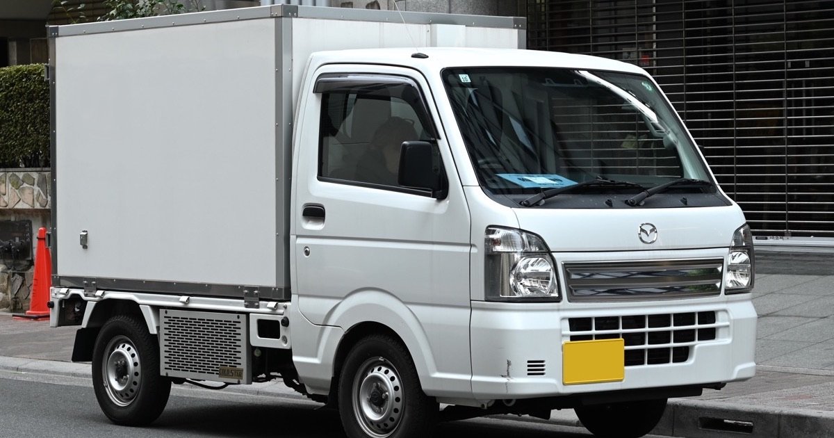
    Cold chain monitoring exists because of one uncomfortable fact: a broken cold chain usually leaves no visible trace. A pallet of frozen goods that spent two hours above its safe temperature looks exactly like one that never did, right up until it is tested, rejected, or makes someone ill. By then the vehicle is long gone and nobody can say what happened. Combining GPS tracking with temperature sensors closes that gap, turning the condition of a load into a continuous, timestamped record instead of an assumption. This guide covers how cold chain monitoring works and what refrigerated fleets should expect from it.

    What cold chain monitoring actually measures

    Vehicle tracking answers where a load is. Cold chain monitoring adds what condition it is in, and just as importantly, ties the two together. A temperature reading on its own is data. A temperature reading attached to a place and a time becomes evidence.

    A typical refrigerated setup records several things continuously:

    • Compartment temperature, sampled at regular intervals throughout the journey.
    • Multiple zones, where a vehicle carries chilled and frozen goods in separate compartments.
    • Door events, since an open door is the most common reason temperature rises.
    • Position and stop history, so any excursion can be tied to a specific location and moment.
    • Engine and reefer status, which distinguishes a genuine cooling failure from a unit that was switched off.

    Why the alert matters more than the report

    Most cold chain systems can produce a report after the fact. The difference between an adequate system and a good one is whether anyone was told while the load could still be saved.

    A temperature excursion is often recoverable if someone acts quickly: the door was left open at a delivery stop, the reefer tripped, a setpoint was changed by mistake. Ten minutes of warming is a correctable problem. Three hours is a rejected load. That is why alerting is the heart of cold chain monitoring, and why the alert has to reach a person who can act, on their phone, immediately. A daily summary email is a record of the loss, not a defence against it.

    Good practice is to alert on the trend as well as the threshold. A compartment climbing steadily towards its limit is a problem that can still be fixed. Waiting until it crosses the line means acting after the damage has begun.

    Proving the chain was never broken

    The commercial value of cold chain monitoring shows up in disputes. When a customer rejects a delivery claiming it arrived warm, the argument is usually unwinnable without data, and the carrier absorbs the loss. With continuous logging, the entire journey can be replayed: the temperature held steady, the doors opened only at scheduled stops, the vehicle went directly from collection to delivery.

    That record protects in both directions. It defends a carrier who did everything correctly, and it identifies genuine failures honestly so they can be fixed rather than argued about. It also underpins the audits that pharmaceutical, food and agricultural customers increasingly require, and it pairs naturally with the geofenced arrival and departure timings described in our guide to geofencing for fleets.

    Where cold chains actually break

    Failure point What causes it What catches it
    Loading dock Goods standing on a warm dock before loading Temperature log plus stop duration
    Delivery stops Doors held open too long during unloading Door sensor plus temperature alert
    Reefer failure Unit trips, loses power or is switched off Reefer status and threshold alert
    Wrong setpoint Unit set for chilled when the load is frozen Setpoint check at the start of the trip
    Unscheduled stops Long breaks with the unit off to save fuel Stop alerts combined with temperature trend

    The pattern is worth noticing: most failures happen while the vehicle is stationary, not while it is driving. Monitoring that only looks at the journey misses the moments when most losses occur.

    Fitting cold chain monitoring to a refrigerated fleet

    The hardware side is straightforward: a tracking device in the cab, one or more wireless temperature probes in the compartments, and optionally door sensors and a connection to the refrigeration unit. Everything reports through the same platform as the vehicle’s position, which matters because two separate systems mean two separate logins and no way to tie condition to location.

    The operational side takes more thought. Decide the thresholds for each product type, decide who receives which alert, and decide what the driver is expected to do when one arrives. An alert with no agreed response is just noise, and a fleet that learns to ignore alerts is in a worse position than one with none. The same discipline that makes fleet reports useful, covered in how to read your fleet reports, applies here.

    Beyond temperature: the rest of the operation

    Refrigerated fleets still face every ordinary fleet problem. Reefer units burn fuel and are a common target for theft, so the controls in reducing fuel theft in your fleet apply directly. Delivery windows are tight, which makes route planning and live tracking commercially important. And because the loads are valuable, security features such as geofencing and remote immobilisation carry more weight than in general haulage. Cold chain monitoring works best as one capability inside a complete tracking platform rather than a separate box bolted on the side, which is how it is built into the Fleetile platform.

    Frequently asked questions

    What is cold chain monitoring?

    It is the continuous recording of a load’s temperature throughout its journey, tied to the vehicle’s position and timing, so you can prove the goods stayed within their safe range from collection to delivery and be alerted immediately if they do not.

    How often should temperature be recorded?

    Frequently enough that a short excursion cannot hide between readings, which in practice means every few minutes rather than once a trip. The exact interval usually depends on the product and on what your customers or regulators require, so confirm their expectations before setting it.

    Can I get an alert before the load is damaged?

    Yes, and this is the most valuable part of the system. Alerts can fire on a threshold being crossed or on a temperature trending steadily towards its limit, which gives a driver or manager time to close a door, restart a unit or correct a setpoint while the load is still within specification.

    Does cold chain monitoring work with multiple compartments?

    It does. Separate probes report each zone independently, so a vehicle carrying frozen goods in one compartment and chilled goods in another is monitored against the correct threshold for each rather than a single average.

    What happens if the vehicle loses mobile signal?

    The device continues recording readings and uploads them once signal returns, so the log stays complete. Live alerting is the part that pauses, which is why routes through known dead spots deserve extra attention at the planning stage.

    See the whole journey, condition included

    The clearest way to judge cold chain monitoring is to watch temperature, doors, stops and position on one screen for a single trip. Get a Fleetile demo and see how the record comes together.

  • Fuel Tanker Tracking: GPS Monitoring for Oil and Gas Fleets

    Fuel Tanker Tracking: GPS Monitoring for Oil and Gas Fleets

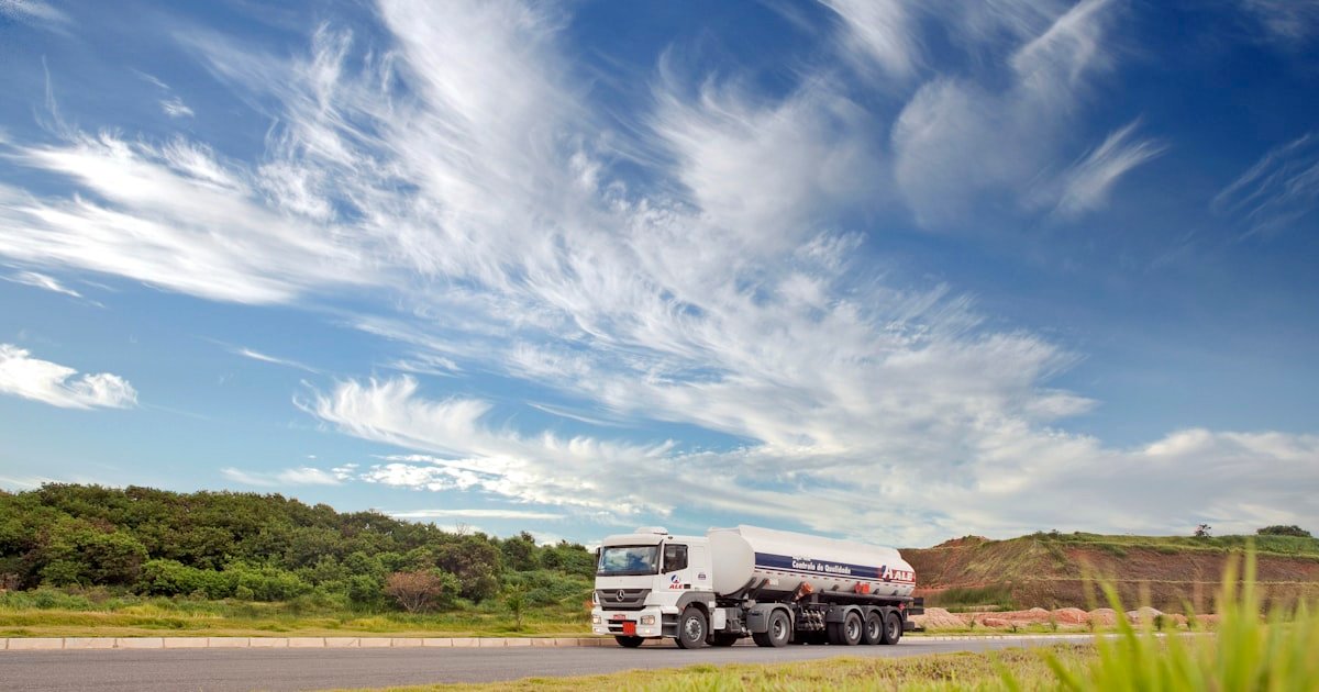
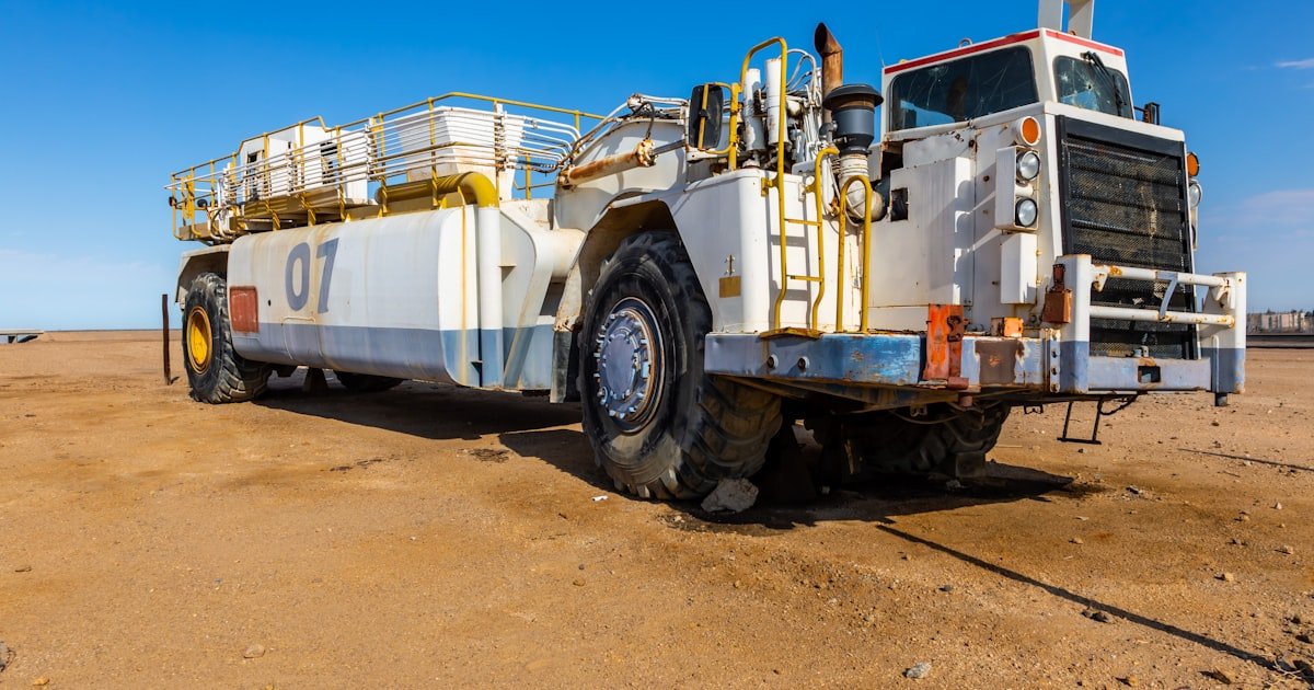
    In most fleets the vehicle is the valuable thing. In oil and gas, the load usually costs more than the truck carrying it, and it is also flammable, regulated and attractive to thieves. That combination makes fuel tanker tracking a different exercise from ordinary vehicle tracking. You are not just watching where a tanker is, you are confirming that the right quantity went from the right terminal to the right customer, along an approved route, without an unexplained stop on the way. This guide covers how GPS tracking is used on tanker fleets and which controls matter most.

    What makes tanker fleets high risk

    Three characteristics drive everything about how tanker fleets are monitored:

    • Load value: a full tanker represents a large sum in a single vehicle, which makes it a target.
    • Divertible product: fuel can be siphoned or short-delivered in quantities small enough to go unnoticed on any single trip.
    • Safety exposure: a hazardous load turns an ordinary accident into a serious incident, so driving standards and route choice carry real consequences.

    Each of these has a tracking answer, and together they explain why tanker operators tend to run tighter monitoring than almost any other kind of fleet.

    Route adherence: the core control

    Most tanker journeys are known in advance. The vehicle loads at a terminal, follows an approved route, and discharges at a named site. That predictability is the strongest control available, because any deviation from the plan is immediately visible and worth a question.

    Fuel tanker tracking makes this practical. Geofences around the loading terminal and each delivery point record exactly when the vehicle arrived and left. A defined corridor along the approved route triggers an alert if the tanker leaves it. An unscheduled stop, especially a long one in an unusual place, is flagged rather than discovered later in a report nobody read. The building block here is geofencing, covered in our guide to what geofencing is and how fleets use it.

    Catching product loss

    Product loss on tanker fleets is rarely dramatic. It is small amounts, repeated, in ways that individually look like measurement error. The way to catch it is to make every stop explainable. When a tanker stops for twenty minutes at an unremarkable spot between the terminal and the delivery site, the tracking record turns that into a specific question with a time and a location attached, which is a very different conversation from a monthly variance nobody can account for.

    Combined with delivery timings from geofences, this builds a chain of custody for each load: loaded here at this time, travelled this route, stopped here for this long, discharged there at that time. The same reconciliation logic that catches fuel skimming in ordinary fleets, described in reducing fuel theft in your fleet, applies with far more value when the product itself is the cargo.

    Theft and hijack response

    A loaded tanker is a target, and the response to a hijack has to be immediate. Fuel tanker tracking supports this in three ways. Live positions update every few seconds so the vehicle can be followed rather than searched for. Movement alerts outside scheduled hours flag a tanker that should be parked. And remote engine cut allows a stopped vehicle to be immobilised so it cannot be driven further, which is explained in our article on the remote engine immobiliser.

    The rule with immobilisation on a hazardous load is simple and non-negotiable: it is a recovery tool used on a stationary vehicle in coordination with the authorities, never a way to stop a moving tanker.

    Driver behaviour on hazardous loads

    A tanker carrying liquid handles differently from a rigid load, since the fuel moves inside the tank during braking and cornering. That makes smooth driving a safety requirement rather than a fuel-economy preference. Speed, harsh braking and sharp cornering all deserve closer monitoring than they would get on a general haulage fleet, and the coaching conversation is easier because the reason is obvious to any experienced tanker driver. Our guide to driver behaviour monitoring covers how to turn this data into training rather than blame.

    What a tanker tracking setup typically includes

    Capability What it protects against
    Live GPS tracking Loss of visibility, slow theft response
    Terminal and site geofences Disputed loading and delivery times
    Route corridor alerts Unauthorised diversions
    Unscheduled stop alerts Product siphoning
    Out-of-hours movement alerts Theft and unauthorised use
    Remote engine cut Hijack and vehicle theft
    Driver scoring Rollover and incident risk
    Full trip history Disputes, audits and investigations

    Compliance and the value of the record

    Tanker operations are audited, by regulators, by customers and internally after any incident. The most underrated benefit of fuel tanker tracking is that it produces a defensible record automatically. When a customer disputes a delivery time, or an investigation asks what route a vehicle took, the answer is a replay rather than a recollection. Keeping that history intact and exportable is worth confirming with any provider before you commit, because a record you cannot retrieve is not much of a record.

    You can see the underlying capabilities, from geofencing and alerts to trip history and remote commands, on the Fleetile platform page.

    Frequently asked questions

    How does fuel tanker tracking prevent product theft?

    It makes every stop visible and explainable. Geofences record exact loading and discharge times, route corridors flag diversions, and unscheduled stop alerts highlight the pauses where siphoning happens. Individually small losses become obvious once each one has a time and a place attached to it.

    Can a tanker be immobilised remotely if it is hijacked?

    Yes, where a remote engine cut relay has been installed. On a hazardous load it should only ever be used once the vehicle has stopped and in coordination with the authorities, as a way to prevent it being driven further rather than to halt it in motion.

    What is route adherence and why does it matter for tankers?

    Route adherence means confirming the vehicle followed its approved path. It matters on tanker fleets because journeys are planned in advance between known points, so any deviation is both unusual and worth investigating immediately, whether the cause is theft, an unsafe shortcut or a genuine road closure.

    Does tracking help with safety as well as security?

    It does. Speed, harsh braking and cornering data identify the driving habits that raise rollover risk on a liquid load, allowing targeted coaching. Trip history also supports proper incident investigation, which is how safety programmes improve over time.

    How long should tanker trip history be kept?

    Long enough to cover your audit, customer dispute and investigation needs, which is usually considerably longer than a general fleet requires. Confirm the retention period with your provider and check that the data can be exported, because history you cannot retrieve will not help during an audit.

    See tanker tracking working

    Watch a geofence trigger on arrival, an off-route alert fire, and a full trip replay assembled from real positions. Get a Fleetile demo and see how fuel tanker tracking protects both the load and the record.

  • Ambulance Tracking System: GPS Tracking for Healthcare Fleets

    Ambulance Tracking System: GPS Tracking for Healthcare Fleets

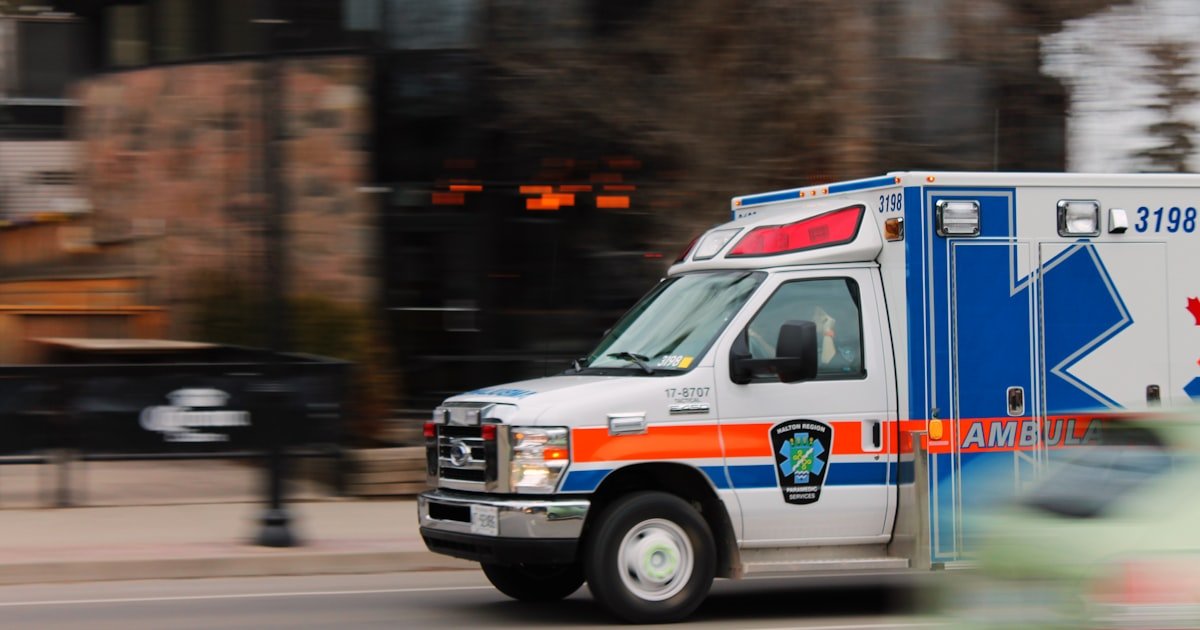
    In every other fleet, GPS tracking saves money. In an ambulance tracking system, it saves time, and time is the outcome. When a call comes in, the only question that matters is which unit can reach the patient fastest, and answering it correctly requires knowing exactly where every ambulance is right now. This guide covers how GPS tracking works for ambulances and healthcare fleets, what it changes in dispatch, and which features matter most when lives depend on the answer.

    Why an ambulance tracking system is different

    A delivery fleet optimises for cost. An emergency medical fleet optimises for response time, and everything else follows from that. The consequences of a slow or wrong dispatch decision are not a late parcel, so an ambulance tracking system has to be judged on a stricter standard than an ordinary vehicle tracking setup.

    Three things change as a result. Position updates need to be genuinely live, because a dispatcher working from a two-minute-old map is choosing the wrong ambulance. Status matters as much as location, since an ambulance already carrying a patient is not available regardless of how close it is. And the record of what happened must be complete, because response times get reviewed, questioned and reported on.

    Nearest-unit dispatch, done properly

    The single largest gain from an ambulance tracking system is choosing the right vehicle. Without live tracking, dispatch works from memory and radio calls: someone believes a unit is near the hospital, so that unit is sent. With live GPS tracking, the dispatcher sees every ambulance on one map, knows which are free, and sends the one that can genuinely arrive first, which is not always the one that looks closest in a straight line.

    That distinction matters more in dense cities than anywhere else. The nearest ambulance by distance may be on the wrong side of a divided road or behind traffic. Live positions combined with actual road routing let a dispatcher make the decision on arrival time rather than proximity. The underlying mechanics are the same ones described in how GPS vehicle tracking works, applied to a case where the stakes are far higher.

    What healthcare fleets track beyond ambulances

    Hospitals and healthcare groups run more than emergency vehicles, and the same tracking platform usually covers all of them:

    • Ambulances: emergency response and patient transfers between facilities.
    • Patient transport vans: scheduled, non-emergency journeys where punctuality is the measure.
    • Sample and specimen couriers: laboratory runs where delays affect test validity.
    • Blood and pharmacy deliveries: temperature-sensitive loads moving between sites.
    • Home care and community nursing vehicles: staff visiting patients across a wide area.

    Each of these has a different definition of success, but all of them benefit from the same foundation: knowing where the vehicle is, where it has been, and whether it is running to plan.

    Features that matter in an ambulance tracking system

    Live tracking with fast updates

    Position needs to refresh every few seconds while moving. Anything slower and dispatch decisions are made on stale information.

    Geofencing around hospitals and zones

    Geofences around hospitals, bases and coverage areas automatically record arrival and departure times, so response and handover times are captured without anyone writing them down. Our guide to geofencing for fleets covers how these boundaries are set up.

    Complete trip history and route replay

    Every journey should be reconstructable afterwards: the route taken, the timings, the stops. This is what turns a disputed response time into a documented one, and it is invaluable during incident reviews.

    Driver behaviour, handled carefully

    Speed and harsh-braking data need context in an emergency fleet, since an ambulance on an emergency call is legitimately driven differently from one returning to base. Used well, the data identifies genuine risk and training needs rather than punishing crews for doing their job. Our article on driver behaviour monitoring explains how to make that distinction.

    Maintenance and vehicle availability

    An ambulance out of service is a hole in coverage. Tracking mileage and engine hours lets servicing be scheduled around demand rather than discovered by a breakdown, which is the same discipline covered in fleet maintenance management.

    The reporting that healthcare fleets are asked for

    Healthcare operations are accountable to boards, regulators and often the public, and most of what they are asked for comes directly out of tracking data:

    Question Answered by
    What is our average response time by area? Dispatch timestamp to geofence arrival
    Which zones are under-covered? Vehicle position history over time
    How long are handovers taking? Time inside the hospital geofence
    Are vehicles being used outside duty hours? Out-of-hours movement alerts
    What route did unit 12 take on that call? Route replay for the trip

    Getting the human side right

    Tracking an emergency fleet only works if the crews trust it. The framing that succeeds is straightforward and honest: the system exists so that the closest unit is sent, so that response times are recorded accurately rather than estimated, and so that nobody has to defend a timeline from memory. Crews who understand that tracking protects their account of events tend to support it. Crews who are told nothing assume the worst. Explain what is recorded, who can see it and what it is used for, before the first device is fitted.

    Frequently asked questions

    How does an ambulance tracking system reduce response times?

    It lets a dispatcher see every unit’s live position and availability on one map, so the ambulance that can actually arrive first is chosen rather than the one assumed to be closest. It also removes the radio back-and-forth needed to establish where units are, which is time spent before the vehicle has even started moving.

    Can tracking record response times automatically?

    Yes. Geofences around hospitals, bases and response areas log arrival and departure automatically, so the times are captured as the vehicle moves rather than written down afterwards. That produces a consistent record for reporting and review without adding paperwork for crews.

    Does GPS tracking work inside hospital grounds and basements?

    GPS needs a view of the sky, so accuracy drops in underground parking and inside buildings. In practice this rarely matters, because the geofence around the hospital has already recorded the arrival, and the device resumes normal reporting as soon as the vehicle is outside again.

    Is tracking ambulance crews intrusive?

    It tracks the vehicle, not the person, and the fairest implementations are transparent about exactly what is recorded and why. Because it also documents that a crew responded promptly and took a sensible route, crews frequently find it works in their favour during reviews.

    Can the same system track patient transport and courier vehicles?

    Yes. Ambulances, patient transport vans, laboratory couriers and community nursing vehicles all run on the same platform, each with their own alerts and reports, which gives a healthcare group one view of every vehicle it operates.

    See it on a live map

    The quickest way to judge an ambulance tracking system is to watch a fleet move in real time and see how fast the map reacts. Get a Fleetile demo and see live tracking, geofence timings and route replay working together.

  • GPS Tracking for Agriculture and Farm Vehicles

    GPS Tracking for Agriculture and Farm Vehicles

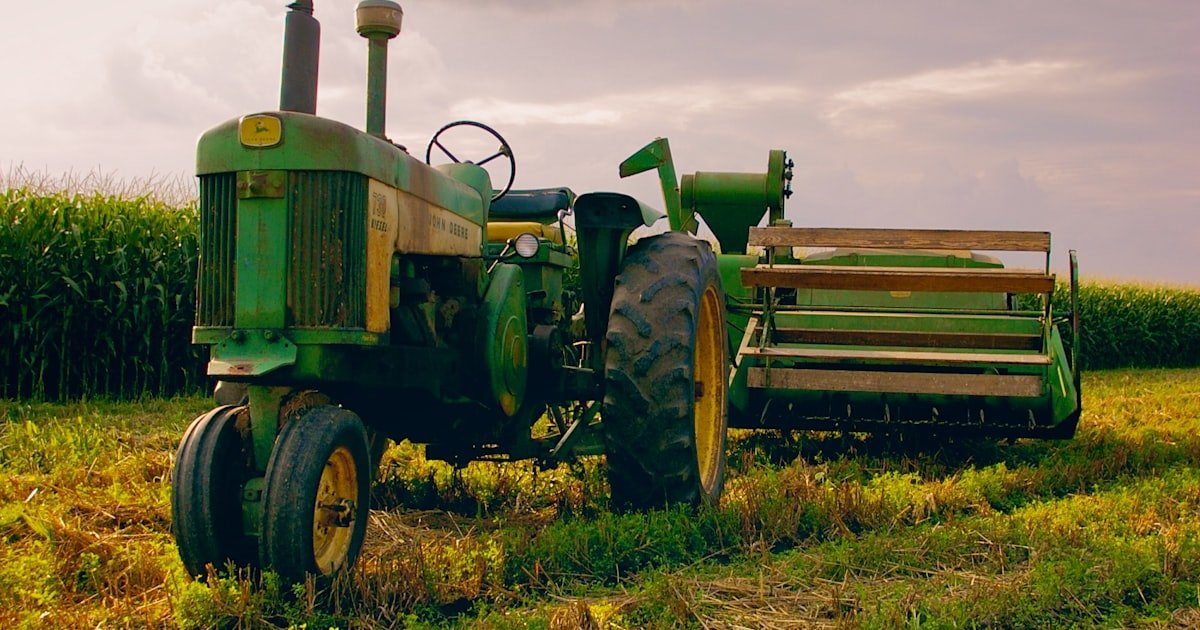
    Farm machinery is some of the most valuable, most mobile and hardest-to-supervise equipment any business owns. A single tractor or harvester can cost more than a fleet of vans, yet it spends its days spread across fields, tracks and remote holdings where no one is watching. Agriculture vehicle tracking puts eyes on all of it - turning tractors, harvesters, trucks and even trailers into assets you can locate, protect and run efficiently from one screen.

    Why agriculture vehicle tracking is different

    Fleet tracking on a farm isn’t the same as tracking delivery vans in a city. The vehicles are high-value and slow to replace, they work across scattered plots with poor mobile coverage, and they’re often left overnight in the open. Theft of both machinery and fuel is a serious, recurring cost, and downtime during a harvest window can cost far more than the equipment itself.

    The underlying technology is the same fleet management foundation used everywhere else - live GPS, geofencing, alerts and reporting - but the priorities shift toward security, fuel control and making the most of every hour a machine is in the field.

    The main problems it solves

    Machinery theft and recovery

    Tractors, quad bikes and implements are prime targets because they’re valuable, portable and often unattended. GPS tracking gives you an instant alert when a machine moves out of hours or leaves its geofenced boundary, and live location to hand to the authorities for recovery. Remote engine cut adds a hard stop: an unauthorised machine can be immobilised so it can’t be driven or trailered away.

    Fuel theft and waste

    Diesel is a huge line item on any farm, and it disappears in two ways: siphoning from tanks and machines, and simple waste through excessive idling and inefficient routes across fields. Tracking exposes both. Trip and idle reports show a harvester left running for hours, while movement and usage patterns flag fuel drawn when a machine shouldn’t be active. If fuel loss is your biggest headache, our guide to reducing fuel theft goes deeper.

    Utilisation and scheduling

    During planting and harvest, machine hours are everything. Tracking shows which equipment is working, which is sitting idle, and how long jobs actually take, so you can balance the fleet across fields and avoid a bottleneck holding up the whole operation.

    Key features for farm fleets

    Feature Value on the farm
    Live GPS tracking Locate every tractor, truck and machine across scattered holdings.
    Geofencing Ring-fence fields, yards and boundaries; get alerts on out-of-area movement.
    Remote engine cut Immobilise stolen machinery so it can’t be driven or towed off.
    Trip history & reports Measure machine hours, idling and field coverage for planning.
    Smart alerts Out-of-hours movement, ignition-on and geofence breaches, instantly.
    Driver scoring Curb harsh use and speeding on road-going farm vehicles.
    iOS & Android apps Check the whole operation from the field, not a farm office.

    How a farm typically rolls it out

    You don’t have to fit everything at once. A sensible order:

    1. Start with the highest-value, highest-risk machines - tractors, harvesters and anything left in the open overnight.
    2. Draw geofences around fields, the main yard and property boundaries so any out-of-area movement is flagged automatically.
    3. Turn on out-of-hours and unauthorised-movement alerts - the biggest early win for theft prevention.
    4. Add road-going trucks and utility vehicles for fuel and driver oversight on public roads.
    5. Review reports weekly during peak season to rebalance machines and cut idling.

    Because a managed provider supplies the GPS device, SIM and installation, the setup is handled for you - important when your team’s expertise is agriculture, not telematics.

    Security first: protecting irreplaceable assets

    For most farms, the standout benefit is asset protection. A stolen harvester mid-season is not just an equipment loss; it can stall an entire operation on a tight weather window. The combination that makes tracking genuinely protective rather than merely observational is geofencing (know the moment something moves), smart alerts (find out instantly, day or night) and remote engine cut (stop the machine from going anywhere). For a broader look at defending vehicles and equipment, see how fleets prevent vehicle theft.

    The same visibility helps with insurance and disputes too. Timestamped trip history proves where a machine was and when it was used - useful for claims, contractor billing and settling any question about hours worked.

    Contract and shared-machinery arrangements benefit as well. Many farms hire in equipment, share machines across neighbouring holdings, or run contracting work on other people’s land. In all of these cases, an independent record of exactly which field a machine worked, for how long, and how far it travelled removes friction from billing and builds trust between everyone relying on the same expensive kit. What used to be a memory-and-goodwill exercise becomes a simple, exportable report.

    Bringing it together

    Agriculture vehicle tracking earns its place by doing three jobs at once: it protects irreplaceable machinery from theft, it clamps down on the diesel that quietly bleeds away, and it gives you the machine-hours data to run a tight operation when every field hour counts. The Fleetile platform brings all of that into one live map with managed hardware, so the technology stays out of your way and the results show up in the field.

    Frequently asked questions

    Will GPS tracking work in remote fields with weak signal?

    Modern trackers store location data when coverage drops and transmit it once signal returns, so you still get a full trip history. Live updates depend on the mobile network, but the record of where a machine has been is preserved even in patchy-coverage areas.

    Can I stop a stolen tractor remotely?

    Yes. With remote engine cut, an unauthorised machine can be immobilised so it can’t be driven or trailered away, and live location helps you and the authorities recover it quickly.

    Does tracking help with fuel theft on the farm?

    It does. Trip and idle reports reveal machines running when they shouldn’t be, and movement patterns flag activity that doesn’t match legitimate work - both common signs of fuel being drawn or wasted.

    Do I need special hardware for farm machinery?

    A GPS device is fitted to each machine. A managed provider supplies the device, SIM and installation, so you don’t need any in-house technical setup to get started.

    See it on your farm fleet

    The best way to judge agriculture vehicle tracking is to watch it run on real machines. Get a Fleetile demo and see live tracking, geofencing and theft protection working across a working fleet.

  • Fleet Management for Small Businesses

    Fleet Management for Small Businesses

    If you run three vans, five service cars or a couple of trucks, you might assume fleet software is built for someone bigger. It isn’t. Fleet management for small business is where the numbers often matter most, because a single stolen vehicle, one wasted tank of fuel a week, or an hour of daily admin hits a small operation far harder than a large one. This guide shows how a small fleet gets real value from GPS tracking without a big team or a big budget.

    Why fleet management matters more for small businesses

    Large fleets have slack in the system. A small fleet doesn’t. When you own a handful of vehicles, every one of them is critical to revenue, and the person running them is usually also doing three other jobs. That’s exactly why visibility pays off quickly here: you replace phone calls, guesswork and paper logs with one live map that answers “where is everyone and what are they doing?” in a glance.

    The core idea is the same as any fleet management setup, just scaled down: track vehicles, control fuel, keep drivers safe, and protect your assets. The difference is that a small business feels the benefit almost immediately, because there’s nowhere for waste to hide.

    The problems a small fleet actually faces

    Most small operators recognise at least a few of these:

    • “Where is the van?” - you’re calling drivers to find out who’s nearest a job or why someone is late.
    • Fuel that doesn’t add up - spend creeps upward and you can’t pin down why.
    • Side jobs and detours - vehicles used out of hours or off-route without you knowing.
    • Theft that ends the week - losing one vehicle can halt the whole business.
    • Admin overload - timesheets, mileage claims and “what time did you leave?” disputes eat your evenings.

    GPS fleet tracking turns each of these from a guessing game into a fact you can see.

    What small businesses get from GPS fleet tracking

    You don’t need every enterprise feature. A focused set of tools covers the vast majority of small-fleet needs:

    Feature What it solves for a small fleet
    Live GPS tracking See every vehicle in real time; assign the nearest one to a job.
    Geofencing Get alerted when a vehicle leaves the yard, a job site or its area.
    Remote engine cut Immobilise a stolen vehicle so it can’t be driven away.
    Driver scoring Spot speeding and harsh braking before they cause accidents.
    Trip history & reports Settle “what time were you there?” disputes and verify mileage.
    Smart alerts Instant warnings for out-of-hours use, overspeeding and idling.
    iOS & Android apps Run the whole fleet from your phone between jobs.

    How the savings stack up

    For a small business, the return usually comes from three directions at once:

    1. Fuel - cutting idling, detours and unauthorised trips trims the biggest recurring cost. Pair tracking with a few habit changes and the fuel line moves fast. Our guide to improving fleet fuel efficiency breaks this down.
    2. Theft prevention - geofencing plus remote engine immobilisation means a stolen vehicle can be stopped and located, protecting an asset a small business can’t afford to lose.
    3. Time - automatic trip logs, mileage and timestamps replace the admin that used to fill your evenings.

    Because a small fleet has few vehicles, even modest per-vehicle savings add up to a meaningful share of the total. That’s why many small operators recover the cost well inside the first few months.

    Do you need to be technical? No.

    A common worry is that fleet software means IT projects, complicated installs and staff training. With a managed platform, it doesn’t. The provider supplies the GPS device, SIM and installation, so the hardware side is handled for you. You get a login, an app on your phone, and a live map. If you can use a maps app, you can run your fleet.

    Start small and grow. There’s no rule that says you must fit every vehicle at once. Many small businesses begin with their highest-value or highest-risk vehicles, see the reports, and roll it out from there.

    Getting the most out of it

    A few habits turn tracking into results:

    • Set geofences around your yard, key sites and service areas so movement outside them is flagged automatically.
    • Review the driver scores weekly - a two-minute glance catches the speeding and harsh braking that lead to accidents and higher insurance.
    • Use trip reports for invoicing and disputes instead of trusting memory.
    • Turn on the alerts that matter to you - out-of-hours ignition and geofence exits are the big two for small fleets.

    For a wider view of trimming spend, see how small operators cut fleet costs across fuel, maintenance and admin. And if you’re weighing the setup itself, the Fleetile platform and a quick demo are the fastest way to see it on your own vehicles.

    Frequently asked questions

    Is fleet management worth it for just a few vehicles?

    Yes. A small fleet feels waste more sharply than a large one, so the savings on fuel, theft and admin often cover the cost within a few months. You don’t need a minimum number of vehicles to benefit.

    Do I need to install anything myself?

    No. A managed provider supplies the GPS device, SIM and installation. You just use the software and the mobile app to track vehicles and receive alerts.

    Can I manage a small fleet from my phone?

    Yes. Platforms like Fleetile offer full iOS and Android apps, so you can see live locations, get alerts and send remote commands between jobs without being at a desk.

    Will tracking help if a vehicle is stolen?

    Absolutely. Geofencing alerts you to unauthorised movement, remote engine cut lets you immobilise the vehicle, and live location supports fast recovery with the authorities.

    See it on your own vehicles

    The clearest way to judge fleet management for a small business is to watch it run on a real fleet. Get a Fleetile demo and see live tracking, geofencing and theft protection working end to end.

  • Fleet Safety: How to Reduce Accidents and Protect Drivers

    Fleet Safety: How to Reduce Accidents and Protect Drivers

    Strong fleet safety isn’t luck - it’s a system. Most collisions involving work vehicles trace back to a handful of behaviours: speeding, harsh braking, fatigue and distraction. Each one is visible, measurable and coachable if you have the right data. This guide lays out a practical approach to reducing accidents and protecting drivers, using the tools a modern GPS platform already puts in your hands.

    Why fleet safety is a business problem, not just a moral one

    Every accident carries a stack of costs that land on the business: vehicle repairs, downtime while a vehicle is off the road, higher insurance premiums, missed jobs, and the human cost of an injured driver. A single serious collision can wipe out a month of margin. Treating safety as a system - something you measure and improve - protects both your people and your bottom line. It also connects directly to cost control; our guide on how to cut fleet costs shows how safety and spend move together.

    The behaviours behind most accidents

    You can’t fix what you can’t see. These are the recurring behaviours that drive collision rates up, and all of them can be detected from vehicle data:

    • Speeding - higher speed means less reaction time and far worse impact energy.
    • Harsh braking and acceleration - signals of tailgating, distraction or aggressive driving.
    • Sharp cornering - taking bends too fast, a common rollover and loss-of-control factor.
    • Fatigue - long unbroken shifts and out-of-hours driving raise risk sharply.
    • Idling and route chaos - rushed, disorganised driving to make up lost time.

    The good news is that every one of these leaves a trace in GPS and telematics data, which means every one can be turned into a number and improved.

    Build a fleet safety program in five steps

    A safety program doesn’t need to be complicated. It needs to be consistent. Here’s a framework that works for fleets of any size.

    1. Measure a baseline. Turn on driver scoring and let it run for a few weeks. You can’t show improvement without a starting point.
    2. Set clear thresholds. Decide what “too fast” and “too harsh” mean for your operation, and configure alerts around them.
    3. Coach with evidence, not opinion. Sit down with drivers using their actual trip data - specific events beat vague warnings every time.
    4. Recognise good driving. Scores make safe drivers visible. Rewarding the top performers changes culture faster than punishing the bottom.
    5. Review and repeat. Check scores monthly, track the trend, and adjust. Safety is a habit, not a one-off campaign.

    How GPS tracking data reduces accidents

    A live tracking platform gives you the raw material for all five steps. Here’s how the specific features map to safer driving.

    Feature How it improves safety
    Driver scoring Grades each driver’s behaviour so you can coach the riskiest and reward the safest
    Speed alerts & speed-camera warnings Flags speeding in real time and warns drivers approaching camera zones
    Harsh-event detection Captures harsh braking, acceleration and cornering for targeted coaching
    Geofencing Alerts on entry to high-risk areas or out-of-hours movement
    Trip history & reports Provides the evidence for coaching and for incident investigation

    Driver scoring is the centrepiece. When drivers know their behaviour is measured - and that a good score is recognised - the risky habits tend to fall away on their own. For a deeper look at the mechanics, see our guide to driver behaviour monitoring.

    Real-time alerts catch problems as they happen

    A monthly report tells you a driver sped last week; a real-time alert lets you address it today. Speed alerts, harsh-event flags and geofence notifications turn safety from a retrospective exercise into a live one. Fleetile ships 30+ smart alerts covering exactly these events, so the risky moments surface immediately rather than buried in a spreadsheet.

    Reports turn incidents into evidence

    When something does go wrong, full trip history lets you replay the journey minute by minute - what speed, what route, what happened just before. That protects a driver who was in the right and gives you honest evidence for coaching when they weren’t. It’s also invaluable in an insurance dispute.

    Safety and security reinforce each other

    A safer fleet is usually a more secure one, because the same platform that scores driving also protects the vehicle. Geofencing flags unauthorised out-of-hours use, and remote engine immobilisation stops a vehicle being taken - both of which cut the risky, unplanned journeys that lead to accidents. If theft is a concern on your fleet too, our guide on how to prevent vehicle theft covers that side in depth. You can see how safety and security features sit together on the platform overview.

    Frequently asked questions

    How does GPS tracking improve fleet safety?

    It makes risky driving visible and measurable. Driver scoring, speed alerts and harsh-event detection let you coach specific behaviours with real evidence, while trip history helps investigate incidents fairly. Drivers who know they’re measured tend to drive more safely on their own.

    What is driver scoring and does it actually reduce accidents?

    Driver scoring grades each driver on behaviours like speeding, harsh braking and cornering, producing a comparable score. It works because it turns safety into something concrete you can coach and reward - visibility and recognition change habits far more reliably than occasional warnings.

    Can real-time alerts really prevent collisions?

    They shift safety from after-the-fact to in-the-moment. A speeding or harsh-driving alert lets you address a pattern the same day rather than a month later, and speed-camera warnings prompt drivers before a risky stretch - catching problems while they’re still small.

    How do I start a fleet safety program?

    Measure a baseline with driver scoring, set clear thresholds for speed and harsh events, coach drivers using their real trip data, recognise your safest drivers, then review monthly. Consistency matters more than complexity - a simple program run every month beats an elaborate one that fizzles out.

    See fleet safety tools in action

    The fastest way to understand how this works is to watch it live. Get a Fleetile demo and see driver scoring, speed alerts and trip reports running on real vehicles - the exact tools that turn fleet safety from a hope into a system.

  • GPS Tracking for School Buses and Passenger Transport

    GPS Tracking for School Buses and Passenger Transport

    When a vehicle carries a load of parcels, tracking is about efficiency. When it carries children, tracking is about safety - and the stakes change completely. School bus GPS tracking gives operators, schools and parents a live view of exactly where a bus is, how it’s being driven, and whether it’s running to schedule. This guide explains what tracking does for school and passenger transport, the features that matter most, and how it turns anxious phone calls into quiet confidence.

    Why school bus GPS tracking matters

    Passenger transport carries a duty of care that ordinary freight doesn’t. A late or missing bus isn’t a logistics problem; it’s a worried parent and a school office fielding calls. GPS tracking answers the core questions before anyone has to ask them: Where is the bus right now? Is it on route? Is it being driven safely? Did it reach every stop?

    Beyond reassurance, tracking creates accountability. Every journey is recorded, so if there’s ever a dispute about timing, routing or an incident, there’s an objective record instead of conflicting memories. That protects the operator, the driver and the passengers alike. It also underpins good management: with data on how each route runs day to day, an operator can spot chronic lateness, a stretch of road that always causes delays, or a driver whose scores drift over time - and act before a small problem becomes a complaint.

    The features that matter most for passenger transport

    Not every fleet feature carries equal weight when children and passengers are aboard. These are the ones that count:

    Feature What it does for passenger transport
    Live GPS tracking Shows the bus’s exact position and speed in real time, so schools and dispatchers always know where it is
    Geofencing Draws zones around stops, schools and depots and alerts when the bus arrives or leaves
    Speed & camera alerts Warns on overspeeding and fixed speed cameras - critical with passengers aboard
    Driver scoring Grades harsh braking, acceleration and speeding so you can coach for a smoother, safer ride
    Trip history Keeps a replayable record of every route for accountability and dispute resolution
    Smart alerts Instant notifications for route deviations, unexpected stops and after-hours movement

    Keeping students safe on the route

    Safety on a passenger route comes down to how the bus is driven and whether it stays where it should be. Two features do the heavy lifting here.

    Geofencing lets you draw a zone around every stop and the school itself. When the bus enters or leaves a zone, the platform can fire an alert - so a school office knows the bus has arrived, and a deviation from the expected route is flagged immediately rather than discovered later. If you’re new to the concept, our explainer on geofencing for fleets covers how it works in detail.

    Driver scoring and speed alerts address the way the bus is actually driven. Overspeeding and harsh manoeuvres are exactly what you don’t want with children aboard, and scoring turns those behaviours into an objective measure you can act on. Combined with speed-camera alerts, drivers get a nudge to stay within limits, and operators get evidence of who needs coaching. It’s the same discipline covered in our guide to driver behaviour monitoring, applied where it matters most.

    Peace of mind for parents and schools

    The clearest benefit of school bus tracking is confidence for the people waiting at the other end. When a bus runs late, a dispatcher can see why - traffic, a delayed departure, a longer stop - and give parents a real answer instead of a shrug. When a route changes, everyone works from the same live picture rather than a patchwork of phone calls. And because a platform like Fleetile offers iOS and Android apps, staff can check the fleet from a phone rather than being tied to a desk, which matters most exactly when things go wrong and nobody is sitting at a computer.

    A tracking programme for passenger transport typically delivers:

    • Real-time answers to “where is the bus?” without calling the driver.
    • Arrival awareness at stops and schools through geofence alerts.
    • Safer driving via scoring and speed alerts on every journey.
    • A complete record of routes and timings for accountability.
    • Faster response when something goes off-plan, from a breakdown to a route deviation.

    Choosing a tracking setup for passenger transport

    For a school or transport operator, the practical concern is getting reliable tracking installed without a technical headache. A managed provider supplies the GPS device, the data SIM and professional installation, so the buses come back fitted and ready and you simply use the dashboard and apps. When comparing options, look for the safety-critical features above - live tracking, geofencing, driver scoring and speed alerts - rather than the longest feature list. If you’re weighing a proper fleet platform against a basic consumer device, our comparison of fleet GPS tracking versus car trackers is a useful read, and you can always talk specifics with the Fleetile team.

    Frequently asked questions

    How does GPS tracking make school buses safer?

    It combines live location with driver scoring and speed alerts, so operators can see where every bus is and how it’s being driven. Geofencing around stops and schools flags arrivals and route deviations, and a full trip record adds accountability for every journey.

    Can staff or schools see the bus location in real time?

    Yes. Authorised staff can view live position and speed on a dashboard or through iOS and Android apps, so there’s no need to phone the driver to find out where a bus is or whether it’s on schedule.

    What happens if a bus leaves its planned route?

    With geofencing and route-deviation alerts, the platform notifies dispatchers the moment a bus leaves an expected zone or route, so they can respond immediately rather than finding out after the fact.

    What hardware do school buses need?

    Each bus needs a GPS tracking device with a data SIM. A managed provider supplies the device, SIM and professional installation together, so operators only interact with the software and apps.

    See safer passenger transport in action

    The best way to judge tracking for buses is to watch it live. Get a Fleetile demo and see live location, geofence alerts, driver scoring and speed alerts working together to keep passengers safe.

  • How to Improve Your Fleet’s Fuel Efficiency

    How to Improve Your Fleet’s Fuel Efficiency

    Fuel is usually one of the two or three biggest line items in any fleet budget, and unlike a vehicle purchase you pay it again every single week. The good news is that fleet fuel efficiency is one of the most improvable costs you have - small, consistent changes in how vehicles are driven, routed and maintained add up fast. This guide walks through the practical levers that move fuel consumption, and how the data from a tracking platform turns each one from a guess into a measurable win.

    Why fleet fuel efficiency is worth chasing

    Every litre you don’t burn drops straight to your bottom line. Because fuel is a recurring cost across every vehicle, a modest percentage improvement compounds across the whole fleet, month after month. Better still, the changes that save fuel - smoother driving, less idling, tidier routes, healthier engines - also cut wear, reduce emissions and lower accident risk. It’s one of the few areas where cutting cost and improving safety pull in the same direction.

    The catch is that fuel waste is invisible without measurement. You can’t tell from a receipt how much of a tank went into idling, a needless detour or heavy-footed driving - the pump only shows the total, never the breakdown. That’s exactly the gap telematics fills: it attributes fuel use to specific behaviours, vehicles and trips, so instead of a single monthly number you get a map of where the waste actually sits and who can fix it.

    The biggest drains on fuel

    Before fixing anything, it helps to know where fuel actually leaks away. The main culprits, roughly in order of how much they matter for most fleets:

    Fuel drain Why it costs you How data helps
    Excessive idling An idling engine burns fuel while going nowhere Idling alerts flag the worst offenders and locations
    Harsh driving Hard acceleration and braking spike consumption Driver scoring pinpoints who to coach
    Speeding Fuel use climbs sharply above efficient speeds Overspeed and speed-camera alerts
    Poor routing Longer or congested routes burn more Trip history reveals detours and dead miles
    Unauthorised trips Private use burns company fuel Geofencing and after-hours alerts
    Neglected maintenance Under-inflated tyres and dirty filters cut economy Usage data drives timely servicing

    Practical ways to improve fuel efficiency

    1. Cut idling

    Idling is the easiest win because it’s pure waste - fuel burned while the vehicle isn’t moving. Set an idling threshold, let the platform alert you when a vehicle exceeds it, and share the results with drivers. Simply making idling visible tends to cut it, because most of it is habit rather than necessity.

    2. Tackle driving habits

    Hard acceleration, heavy braking and speeding can swing a vehicle’s fuel use dramatically. Driver scoring grades each driver on exactly these behaviours, giving you an objective basis to coach the heaviest-footed drivers rather than lecturing everyone. Our guide to driver behaviour monitoring covers how to turn those scores into lasting change.

    3. Plan smarter routes

    Trip history shows where vehicles actually went, exposing detours, backtracking and dead miles that quietly add up. Reviewing routes and trimming avoidable distance is a direct fuel saving - and it usually improves delivery times too. Fleets in delivery and logistics see this most sharply; our post on GPS tracking for logistics and delivery goes into route optimisation in depth.

    4. Stop fuel walking off

    Not all fuel loss is about how vehicles are driven - some of it is outright theft or unauthorised use. Geofencing plus after-hours movement alerts catch vehicles being used off the clock, and pattern anomalies can flag suspected siphoning. For the full playbook, see how to reduce fuel theft in your fleet.

    5. Keep vehicles healthy

    A well-maintained vehicle is a fuel-efficient one. Under-inflated tyres increase rolling resistance and quietly raise consumption on every trip; a clogged air filter or a poorly tuned engine does the same. None of it announces itself - the vehicle simply drinks a little more fuel than it should, week after week. Because a tracking platform records real usage such as distance and engine hours, it can help you service each vehicle at the right moment instead of running it inefficiently between fixed calendar dates, keeping economy where it should be.

    Using data to keep the savings

    The difference between a one-off fuel push and a lasting improvement is measurement. A platform like Fleetile gives you the raw material to sustain it:

    • Live GPS tracking to see routes and speeds as they happen.
    • Idling and overspeed alerts among 30+ smart alerts, so waste surfaces immediately.
    • Driver scoring to rank behaviour and target coaching.
    • Trip history and reports to track fuel-linked metrics over time and prove the trend.
    • Geofencing to catch unauthorised use before it costs you.

    Review the numbers on a regular cadence, share driver scores openly, and celebrate improvement. Fuel efficiency responds far more to steady attention than to a single crackdown, and it’s a core part of the wider job of cutting fleet costs across the board.

    Frequently asked questions

    How much can better fuel efficiency really save?

    It varies by fleet, but because fuel is a recurring cost across every vehicle, even a small percentage improvement compounds into meaningful money over a year. The biggest gains usually come from cutting idling and reining in harsh, speeding driving.

    What’s the single fastest way to save fuel?

    For most fleets, reducing idling is the quickest win because it’s pure waste and easy to measure. Setting an idling alert and sharing the results with drivers often cuts it noticeably within weeks.

    Does GPS tracking actually reduce fuel use?

    Indirectly, yes. Tracking itself doesn’t burn less fuel, but the data it provides - idling, speeding, routing and driver behaviour - lets you find and fix the waste you otherwise can’t see, and the visibility alone tends to improve driver habits.

    How does driver behaviour affect fuel consumption?

    Heavily. Hard acceleration, harsh braking and speeding all burn extra fuel compared with smooth, steady driving. Driver scoring identifies which drivers are costing you the most so you can coach them specifically.

    See where your fuel is going

    You can’t improve what you can’t see. Get a Fleetile demo and watch idling, speeding, routes and driver scores on real vehicles - then turn that visibility into a lighter fuel bill.

  • Vehicle Tracking for Car Rental Businesses

    Vehicle Tracking for Car Rental Businesses

    Every car you rent out leaves your lot in the hands of someone you’ve just met, often for days at a time. Car rental GPS tracking is how you keep control of that asset without following it around - knowing where every vehicle is, enforcing your rental terms, recovering overdue or stolen cars fast, and cutting the fraud that eats into thin rental margins. This guide explains exactly how tracking protects a rental fleet and what to look for.

    Why car rental businesses need GPS tracking

    Rental is a uniquely exposed business. Your entire inventory is designed to be driven away by strangers, sometimes across borders, frequently pushed harder than an owner would push their own car. The risks stack up quickly: vehicles not returned on time, cars taken outside permitted areas, reckless driving that trashes the vehicle, and outright theft using fake or stolen identities.

    GPS tracking gives you back control. With a device in every vehicle you always know where your fleet is, get alerted the moment terms are broken, and can act before a small problem becomes a written-off asset. It’s the rental-specific application of core fleet management principles.

    Protecting your fleet from theft and non-return

    The nightmare scenario for any rental operator is a vehicle that simply never comes back. Tracking is the difference between a total loss and a quick recovery:

    • Live location - pinpoint any vehicle instantly, whether it’s overdue, lost or reported stolen.
    • Remote engine cut / immobiliser - prevent a non-returned or stolen car from being driven further, so it can be recovered where it sits.
    • Overdue alerts - flag vehicles that pass their return time so you can act immediately, not days later.
    • Fast recovery - hand police an exact, current position instead of a description and a licence plate.

    Remote immobilisation in particular changes the economics of rental fraud - a car that can’t be driven is a car that gets recovered.

    Enforcing rental terms with geofencing

    Most rental agreements restrict where and how a vehicle can be used, but without visibility those terms are unenforceable. Geofencing makes them real. Draw the permitted area on a map and you’re alerted the moment a customer drives outside it - across a border, into a prohibited region, or beyond an agreed radius.

    Paired with speed and behaviour alerts, you can also enforce the parts of your contract that protect the vehicle itself. To understand how zones and alerts are built, see our explainer on geofencing for fleets.

    Reducing wear, damage and disputes

    Rented cars often get driven harder than owned ones, and that abuse shows up as premature wear, damage and higher maintenance bills. Driver behaviour monitoring records speeding, harsh braking and aggressive acceleration during each rental, which does two things: it discourages reckless driving when customers know it’s tracked, and it gives you evidence when a car comes back damaged.

    Trip history is just as valuable for settling disputes. When a customer denies going somewhere, exceeding a limit or causing damage at a certain time, timestamped location and behaviour data settles it fast and fairly.

    The rental problems tracking solves

    Problem How tracking solves it
    Vehicle not returned Overdue alerts, live location and remote immobiliser
    Driven outside permitted area Geofence breach alerts in real time
    Reckless driving & damage Driver behaviour monitoring and evidence trail
    Theft via fraud Live tracking plus remote engine cut for recovery
    Customer disputes Timestamped trip history as proof
    Idle / unaccounted vehicles Fleet-wide map showing every car’s status

    Running a tighter, more profitable rental operation

    Beyond security, tracking sharpens the day-to-day economics of a rental business. Knowing exactly where every vehicle is - on hire, back in the lot, in for service - means you can turn cars around faster and avoid the dead time where an available vehicle sits unbooked because nobody knew it was free. A live fleet map turns your inventory into something you can actively manage rather than chase.

    Maintenance benefits too. Mileage and usage data let you service each car on real wear instead of a fixed calendar, keeping vehicles roadworthy and reducing the breakdowns that strand customers and damage your reputation. Cleaner records also make it easier to prove condition and mileage at handover, cutting the arguments that eat staff time at the counter and protecting margins that are thin to begin with.

    What to look for in rental fleet tracking

    For rental, the security features matter more than anything else. Prioritise:

    1. Remote engine cut - the most important feature for recovering non-returned and stolen vehicles.
    2. Strong geofencing and alerts - to enforce permitted-area and time terms automatically.
    3. Live, real-time tracking - location every few seconds when you need to act fast.
    4. Driver behaviour and trip history - for damage evidence and dispute resolution.
    5. Mobile apps - so you can check and control the fleet from the counter or on the move.
    6. Managed hardware - device, SIM and installation handled across your whole fleet.

    How Fleetile fits rental fleets

    Fleetile gives rental operators live GPS tracking, geofencing to enforce permitted areas, remote engine cut for recovering non-returned and stolen cars, driver scoring and trip history for damage disputes, and 30+ smart alerts - all in iOS and Android apps with managed hardware. Every car in your fleet stays on one map, so you always know where your inventory is and who’s testing the limits of their agreement.

    Frequently asked questions

    Can I recover a rental car that isn’t returned?

    Yes. Live GPS location shows exactly where an overdue or stolen vehicle is, and remote engine cut prevents it being driven further, so it can be recovered where it sits. This dramatically improves recovery rates compared with tracking alone.

    Can I stop customers driving outside a permitted area?

    You can be alerted the instant they do. Geofencing lets you define permitted regions or a radius, and you get a real-time notification if a vehicle crosses the boundary, so you can enforce your rental terms.

    Does tracking help with damage disputes?

    Yes. Driver behaviour data and timestamped trip history provide an objective record of how and where a car was driven, which settles disputes over damage, speeding or restricted-area use quickly and fairly.

    Is GPS tracking legal for rental vehicles?

    Tracking vehicles you own is generally permitted, but you should disclose it in your rental agreement and follow local privacy laws. Being transparent with customers is both good practice and often a legal requirement.

    See rental tracking in action

    The best way to judge car rental GPS tracking is to see it working on a real fleet. Get a Fleetile demo and watch live tracking, geofencing and remote immobilisation come together on one dashboard.